
Lac Cardin topographic map
Interactive map
Click on the map to display elevation.
About this map
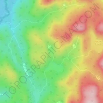
Name: Lac Cardin topographic map, elevation, terrain.
Average elevation: 551 m
Minimum elevation: 432 m
Maximum elevation: 690 m
Other topographic maps
Click on a map to view its topography, its elevation and its terrain.
Lac Henry
Canada > Quebec > Lac-Croche
Lac Henry, Lac-Croche, La Jacques-Cartier, Capitale-Nationale, Quebec, Canada
Average elevation: 693 m
Lac Verneuil
Canada > Quebec > Lac-Croche
Lac Verneuil, Route 162, Lac-Croche, La Jacques-Cartier, Capitale-Nationale, Quebec, Canada
Average elevation: 731 m