
Monte Gauro topographic map
Interactive map
Click on the map to display elevation.
About this map
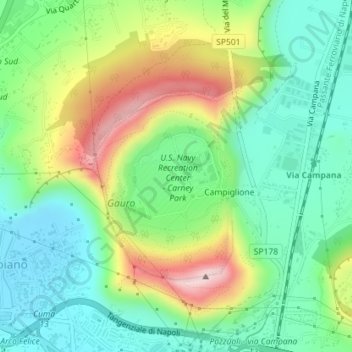
Name: Monte Gauro topographic map, elevation, terrain.
Location: Monte Gauro, Pozzuoli, NA, CAM, 90078, Italia (40.85231 14.10655 40.85241 14.10665)
Average elevation: 123 m
Minimum elevation: 15 m
Maximum elevation: 324 m
Other topographic maps
Click on a map to view its topography, its elevation and its terrain.
Campi Flegrei
Campi Flegrei, Pozzuoli, NA, CAM, 80078, Italia
Average elevation: 76 m