
Samokhvalove topographic map
Interactive map
Click on the map to display elevation.
About this map
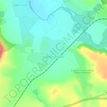
Name: Samokhvalove topographic map, elevation, terrain.
Location: Samokhvalove, Autonomous Republic of Crimea, 98422, Ukraine (44.82024 33.91302 44.82901 33.92745)
Average elevation: 172 m
Minimum elevation: 141 m
Maximum elevation: 246 m