
Yvorne topographic map
Interactive map
Click on the map to display elevation.
About this map
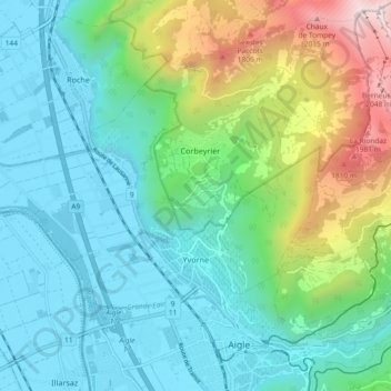
Name: Yvorne topographic map, elevation, terrain.
Location: Yvorne, District d'Aigle, Vaud, 1853, Suisse (46.32397 6.89585 46.36030 6.98812)
Average elevation: 832 m
Minimum elevation: 371 m
Maximum elevation: 2,258 m