Geolocate

Tubod topographic map

Click on the map to display elevation.

About this map

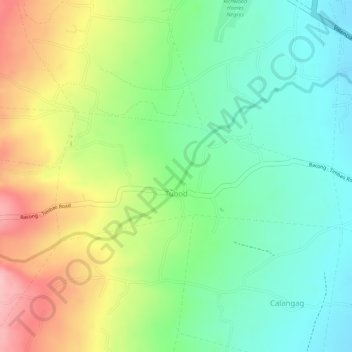
Name: Tubod topographic map, elevation, terrain.

Location: Tubod, Bacong, Negros Oriental, Central Visayas, Philippines (9.24495 123.25466 9.25486 123.27699)

Average elevation: 127 m

Minimum elevation: 55 m

Maximum elevation: 230 m

Gear up for your next adventure:

💧Personal Water Filters - Drink safely from streams and lakes identified on your map
🎒Ultralight Backpacks - Lightweight packs for long hikes
🍶Collapsible Water Bottles - Save space in your pack as you consume your water supply
🔌Fast Charging Adapters - Quickly top up all your gear before heading back into the field
📡Portable Emergency Radios - Stay informed about weather warnings and bushfire alerts

As an Amazon Associate, this site earns from qualifying purchases at no extra cost to you.