
Galicien topographic map
Interactive map
Click on the map to display elevation.
About this map
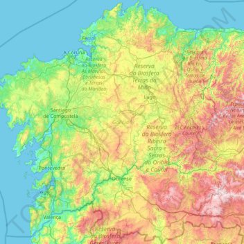
Name: Galicien topographic map, elevation, terrain.
Location: Galicien, Spanien (41.80737 -9.30154 43.79042 -6.73395)
Average elevation: 456 m
Minimum elevation: -2 m
Maximum elevation: 2,088 m
Other topographic maps
Click on a map to view its topography, its elevation and its terrain.