Geolocate

Trinity Beach topographic map

Click on the map to display elevation.

About this map
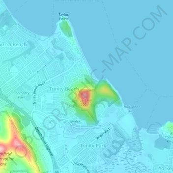
Name: Trinity Beach topographic map, elevation, terrain.

Location: Trinity Beach, Kewarra Beach, Queensland, 4879, Australia (-16.81208 145.68020 -16.77200 145.71513)

Average elevation: 17 m

Minimum elevation: -3 m

Maximum elevation: 201 m

Queensland trails, hiking, mountain biking, running and outdoor activities

Other topographic maps

Click on a map to view its topography, its elevation and its terrain.

Crocodile Park

Australia > Queensland > Kewarra Beach

Average elevation: 29 m

Crocodile Park

Australia > Queensland > Kewarra Beach

Average elevation: 29 m

Gear up for your next adventure:

👟Lightweight Trail Runners - Agile footwear for fast movement over rugged Australian terrain
🥤Hydration Packs - Hydration systems for hiking
👖Convertible Hiking Trousers - Zip-off legs to adapt to changing temperatures throughout the day
🍳Ultralight Camping Stoves - Boil water quickly for meals using minimal fuel
🆘Personal Locator Beacons (PLB) - Satellite emergency beacons for life-saving help in areas with no mobile coverage

As an Amazon Associate, this site earns from qualifying purchases at no extra cost to you.