
Raina topographic map
Interactive map
Click on the map to display elevation.
About this map
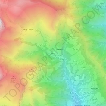
Name: Raina topographic map, elevation, terrain.
Location: Raina, Prazzo, Coni, Piémont, 12028, Italie (44.49476 7.03268 44.53476 7.07268)
Average elevation: 1,834 m
Minimum elevation: 1,188 m
Maximum elevation: 2,629 m
Other topographic maps
Click on a map to view its topography, its elevation and its terrain.