
Lac Omer topographic map
Interactive map
Click on the map to display elevation.
About this map
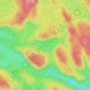
Name: Lac Omer topographic map, elevation, terrain.
Average elevation: 195 m
Minimum elevation: 128 m
Maximum elevation: 253 m
Other topographic maps
Click on a map to view its topography, its elevation and its terrain.
Étang Saint-Pierre
Canada > Québec > Baie-Comeau
Étang Saint-Pierre, Baie-Comeau, Manicouagan, Côte-Nord, Québec, Canada
Average elevation: 142 m