
Thank you for supporting this site ❤️
Make a donation
Make a donation
Gear up for your next adventure:
As an Amazon Associate, this site earns from qualifying purchases at no extra cost to you.
Agordo - Agort topographic map
Click on the map to display elevation.
Thank you for supporting this site ❤️
Make a donation
Make a donation
Gear up for your next adventure:
As an Amazon Associate, this site earns from qualifying purchases at no extra cost to you.
About this map
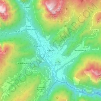
Name: Agordo - Agort topographic map, elevation, terrain.
Location: Agordo - Agort, Agordo, Belluno, Vénétie, 32021, Italie (46.24215 11.99498 46.32215 12.07498)
Average elevation: 1,074 m
Minimum elevation: 475 m
Maximum elevation: 2,278 m
Thank you for supporting this site ❤️
Make a donation
Make a donation
Gear up for your next adventure:
As an Amazon Associate, this site earns from qualifying purchases at no extra cost to you.