
Mount Sugarloaf topographic map
Interactive map
Click on the map to display elevation.
About this map
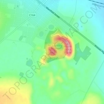
Name: Mount Sugarloaf topographic map, elevation, terrain.
Average elevation: 201 m
Minimum elevation: 158 m
Maximum elevation: 303 m
Other topographic maps
Click on a map to view its topography, its elevation and its terrain.
Camperdown
Australia > Victoria > Camperdown
Camperdown, Shire of Corangamite, Barwon South West, Victoria, 3260, Australia
Average elevation: 170 m
Lake Bullen Merri
Australia > Victoria > Camperdown
Lake Bullen Merri, Camperdown, Shire of Corangamite, Victoria, 3260, Australia
Average elevation: 171 m