
Uyuni topographic map
Interactive map
Click on the map to display elevation.
About this map
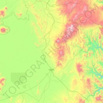
Name: Uyuni topographic map, elevation, terrain.
Location: Uyuni, Antonio Quijarro, Potosí, Bolivien (-20.99074 -67.27036 -19.35550 -66.18732)
Average elevation: 3,884 m
Minimum elevation: 3,229 m
Maximum elevation: 5,517 m
Uyuni ist zentraler Ort des Municipios Uyuni und Verwaltungssitz der Provinz Antonio Quijarro. Die Stadt liegt auf einer Höhe von 3675 m am östlichen Ufer des Salzsees Salar de Uyuni, dem größten Salzsee der Welt.