Geolocate

Somerville topographic map

Click on the map to display elevation.

About this map
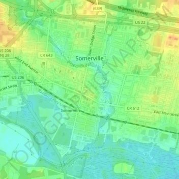
Name: Somerville topographic map, elevation, terrain.

Location: Somerville, Somerset County, New Jersey, United States (40.55609 -74.62638 40.58170 -74.58626)

Average elevation: 21 m

Minimum elevation: 7 m

Maximum elevation: 40 m

Other topographic maps

Click on a map to view its topography, its elevation and its terrain.

Gear up for your next adventure:

📟Satellite Messengers - Two-way satellite communication to stay in touch beyond the cellular grid
🕶️Polarized Outdoor Sunglasses - Reduce glare from rocks and water for better visual navigation
🧥Thermal Emergency Blankets - Compact Mylar blankets to prevent hypothermia if stranded overnight
🎽Hiking Clothing - Breathable clothing for hiking
🧥Packable Rain Jackets - Breathable waterproof layers for unpredictable mountain weather

As an Amazon Associate, this site earns from qualifying purchases at no extra cost to you.