
Mont Cocu topographic map
Interactive map
Click on the map to display elevation.
About this map
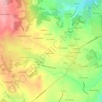
Name: Mont Cocu topographic map, elevation, terrain.
Average elevation: 322 m
Minimum elevation: 226 m
Maximum elevation: 415 m
Other topographic maps
Click on a map to view its topography, its elevation and its terrain.
Chez Mana
France > Nouvelle-Aquitaine > Haute-Vienne > Séreilhac
Chez Mana, Séreilhac, Limoges, Haute-Vienne, Nouvelle-Aquitaine, France métropolitaine, 87620, France
Average elevation: 346 m