
Valdesaz topographic map
Interactive map
Click on the map to display elevation.
About this map
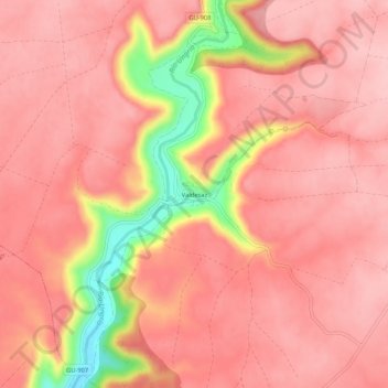
Name: Valdesaz topographic map, elevation, terrain.
Location: Valdesaz, Brihuega, Guadalajara, Castilla-La Mancha, España (40.71045 -2.96709 40.75045 -2.92709)
Average elevation: 971 m
Minimum elevation: 854 m
Maximum elevation: 1,007 m
Other topographic maps
Click on a map to view its topography, its elevation and its terrain.
Malacuera
España > Castilla-La Mancha > Brihuega
Malacuera, Brihuega, Guadalajara, Castilla-La Mancha, 19214, España
Average elevation: 977 m
Olmeda del Extremo
España > Castilla-La Mancha > Brihuega
Olmeda del Extremo, Brihuega, Guadalajara, Castilla-La Mancha, España
Average elevation: 995 m
Tomellosa
España > Castilla-La Mancha > Brihuega
Tomellosa, Brihuega, Guadalajara, Castilla-La Mancha, 19411, España
Average elevation: 881 m