
Massow topographic map
Interactive map
Click on the map to display elevation.
About this map
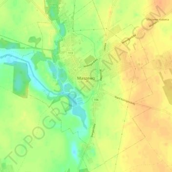
Name: Massow topographic map, elevation, terrain.
Average elevation: 67 m
Minimum elevation: 44 m
Maximum elevation: 81 m
Other topographic maps
Click on a map to view its topography, its elevation and its terrain.
Glewitz
Polen > Woiwodschaft Westpommern > Landkreis Gollnow
Glewitz, Gemeinde Gollnow, Landkreis Gollnow, Woiwodschaft Westpommern, 72-100, Polen
Average elevation: 38 m
Lübzin
Polen > Woiwodschaft Westpommern > Landkreis Gollnow
Lübzin, Gemeinde Gollnow, Landkreis Gollnow, Woiwodschaft Westpommern, 72-105, Polen
Average elevation: 1 m