
Thank you for supporting this site ❤️
Make a donation
Make a donation
Gear up for your next adventure:
As an Amazon Associate, this site earns from qualifying purchases at no extra cost to you.
Anis topographic map
Click on the map to display elevation.
Thank you for supporting this site ❤️
Make a donation
Make a donation
Gear up for your next adventure:
As an Amazon Associate, this site earns from qualifying purchases at no extra cost to you.
About this map
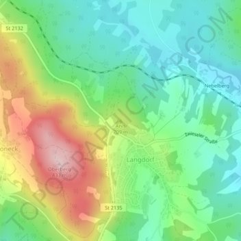
Name: Anis topographic map, elevation, terrain.
Location: Anis, Langdorf, Landkreis Regen, Bayern, 94264, Deutschland (49.01766 13.14422 49.01776 13.14432)
Average elevation: 657 m
Minimum elevation: 565 m
Maximum elevation: 824 m
Thank you for supporting this site ❤️
Make a donation
Make a donation
Gear up for your next adventure:
As an Amazon Associate, this site earns from qualifying purchases at no extra cost to you.