
Hughes County topographic map
Interactive map
Click on the map to display elevation.
About this map
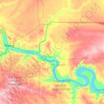
Name: Hughes County topographic map, elevation, terrain.
Location: Hughes County, South Dakota, United States (44.09882 -100.57979 44.54989 -99.59747)
Average elevation: 537 m
Minimum elevation: 429 m
Maximum elevation: 682 m
Other topographic maps
Click on a map to view its topography, its elevation and its terrain.
De Grey
United States > South Dakota > Hughes County
De Grey, Hughes County, South Dakota, United States
Average elevation: 460 m