Geolocate

Water topographic map

Click on the map to display elevation.

About this map
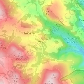
Name: Water topographic map, elevation, terrain.

Location: Water, Teignbridge, Devon, England, TQ13 9UE, United Kingdom (50.59294 -3.77824 50.63294 -3.73824)

Average elevation: 261 m

Minimum elevation: 82 m

Maximum elevation: 413 m

Other topographic maps

Click on a map to view its topography, its elevation and its terrain.

Ipplepen

United Kingdom > England > Devon > Teignbridge

Average elevation: 71 m

Teignmouth

United Kingdom > England > Devon > Teignbridge

Average elevation: 59 m

Gear up for your next adventure:

🌿Flora and Fauna Field Guides - Identify the plants and animals you encounter on your route
🧢Outdoor Sun Hats - Sun protection hats for hiking
🧴Sunscreen SPF - Sun protection for outdoor activities
🧭Compass - Navigation compasses for outdoor exploration
🥶Thermal Beanies - Warm hats for cold hikes

As an Amazon Associate, this site earns from qualifying purchases at no extra cost to you.