
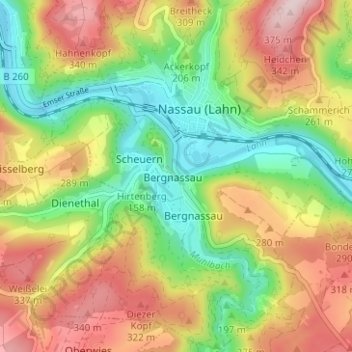
Bergnassau-Scheuern topographic map
Interactive map
Click on the map to display elevation.
About this map
Name: Bergnassau-Scheuern topographic map, elevation, terrain.
Average elevation: 218 m
Minimum elevation: 79 m
Maximum elevation: 385 m
Other topographic maps
Click on a map to view its topography, its elevation and its terrain.
Bergnassau
Deutschland > Rheinland-Pfalz > Rhein-Lahn-Kreis > Nassau
Bergnassau, Nassau, Bad Ems-Nassau, Rhein-Lahn-Kreis, Rheinland-Pfalz, 56377, Deutschland
Average elevation: 218 m