Geolocate

Carnforth topographic map

Click on the map to display elevation.

About this map
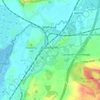
Name: Carnforth topographic map, elevation, terrain.

Location: Carnforth, Warton, Lancaster, Lancashire, England, United Kingdom (54.11237 -2.79634 54.14223 -2.73563)

Average elevation: 28 m

Minimum elevation: 0 m

Maximum elevation: 139 m

Other topographic maps

Click on a map to view its topography, its elevation and its terrain.

Warton Crag

United Kingdom > England > Lancashire > Lancaster > Warton

Average elevation: 45 m

Gear up for your next adventure:

🧺Waterproof Dry Sacks - Organize your pack and keep electronics safe from rain and river crossings
🔑Heavy Duty Carabiners - Secure gear to the outside of your pack for easy access
🧣Merino Neck Gaiters - Versatile headwear for warmth, sun protection, or dust filtering
⌚Altimeter Barometer Watches - Outdoor watches with built-in sensors to track altitude changes and weather shifts
💡Collapsible Camping Lanterns - Illuminate your base camp or tent for map studying at night

As an Amazon Associate, this site earns from qualifying purchases at no extra cost to you.