
Kalaban Coura topographic map
Interactive map
Click on the map to display elevation.
About this map
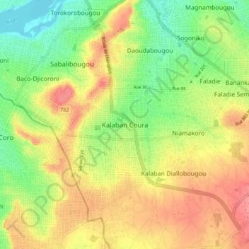
Name: Kalaban Coura topographic map, elevation, terrain.
Location: Kalaban Coura, Mali (12.53658 -8.02728 12.61658 -7.94728)
Average elevation: 352 m
Minimum elevation: 314 m
Maximum elevation: 388 m