
Make a donation
Gear up for your next adventure:
As an Amazon Associate, this site earns from qualifying purchases at no extra cost to you.
Neukamperfehn topographic map
Click on the map to display elevation.
Make a donation
Gear up for your next adventure:
As an Amazon Associate, this site earns from qualifying purchases at no extra cost to you.
About this map
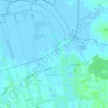
Name: Neukamperfehn topographic map, elevation, terrain.
Average elevation: 1 m
Minimum elevation: -3 m
Maximum elevation: 7 m
Make a donation
Gear up for your next adventure:
As an Amazon Associate, this site earns from qualifying purchases at no extra cost to you.
Other topographic maps
Click on a map to view its topography, its elevation and its terrain.
Make a donation
Gear up for your next adventure:
As an Amazon Associate, this site earns from qualifying purchases at no extra cost to you.
Make a donation
Gear up for your next adventure:
As an Amazon Associate, this site earns from qualifying purchases at no extra cost to you.
Make a donation
Gear up for your next adventure:
As an Amazon Associate, this site earns from qualifying purchases at no extra cost to you.
Make a donation
Gear up for your next adventure:
As an Amazon Associate, this site earns from qualifying purchases at no extra cost to you.
Make a donation
Gear up for your next adventure:
As an Amazon Associate, this site earns from qualifying purchases at no extra cost to you.
Burlage-Langholter Tief
Deutschland > Niedersachsen > Landkreis Leer > Ostrhauderfehn
Average elevation: 6 m
Make a donation
Gear up for your next adventure:
As an Amazon Associate, this site earns from qualifying purchases at no extra cost to you.
Ihrhove
Deutschland > Niedersachsen > Landkreis Leer
Ihrhove liegt im Overledingerland, einem der vier historischen Landstriche im Landkreis Leer. Die Gemarkung umfasst ein Gebiet von 10,02 km2. Das Ortszentrum ist auf einem Geestrand gelegen, etwa 4 km von der Ems entfernt. Die Kirchenwarft erreicht eine Höhe von 5,5 m über Normalnull, während der Hammrich,…
Average elevation: 3 m
Holthuserheide
Deutschland > Niedersachsen > Landkreis Leer > Weener > Holthusen
Average elevation: 2 m
Make a donation
Gear up for your next adventure:
As an Amazon Associate, this site earns from qualifying purchases at no extra cost to you.
Burlage
Deutschland > Niedersachsen > Landkreis Leer
Burlage (Ostfriesisches Platt Burlóóeğ) ist ein Ortsteil der Gemeinde Rhauderfehn im Landkreis Leer in Niedersachsen. Er liegt etwa siebzehn Kilometer südsüdöstlich von Leer und gut elf Kilometer östlich von Papenburg auf einer Höhe von etwa zwei Meter über NHN. Der Ortsteil besteht aus den…
Average elevation: 6 m
Make a donation
Gear up for your next adventure:
As an Amazon Associate, this site earns from qualifying purchases at no extra cost to you.
Make a donation
Gear up for your next adventure:
As an Amazon Associate, this site earns from qualifying purchases at no extra cost to you.
Oldersum
Deutschland > Niedersachsen > Landkreis Leer
1631 wurde die hochverschuldete Herrlichkeit Oldersum an die damals auf einem wirtschaftlichen Höhepunkt befindliche Stadt Emden verkauft. 1744 wurde Oldersum mit der Eingliederung Ostfrieslands nach Brandenburg preußisch.
Average elevation: 0 m
Make a donation
Gear up for your next adventure:
As an Amazon Associate, this site earns from qualifying purchases at no extra cost to you.
Make a donation
Gear up for your next adventure:
As an Amazon Associate, this site earns from qualifying purchases at no extra cost to you.
Make a donation
Gear up for your next adventure:
As an Amazon Associate, this site earns from qualifying purchases at no extra cost to you.
Ockenhausen
Deutschland > Niedersachsen > Landkreis Leer > Uplengen > Ockenhausen
Average elevation: 11 m
Make a donation
Gear up for your next adventure:
As an Amazon Associate, this site earns from qualifying purchases at no extra cost to you.
Idafehn
Deutschland > Niedersachsen > Landkreis Leer
Die wiederaufgebaute Mühle Idafehn ist eine von drei Windmühlen, die sich auf dem Gebiet der heutigen Gemeinde Ostrhauderfehn befanden. Die ursprünglich im Oktober 1891 gebaute Windmühle wurde während des Orkans Quimburga am 13. November 1972 durch ein Feuer zerstört. Die Orkanböen hatten die…
Average elevation: 3 m
Make a donation
Gear up for your next adventure:
As an Amazon Associate, this site earns from qualifying purchases at no extra cost to you.
Völlenerkönigsfehn
Deutschland > Niedersachsen > Landkreis Leer > Völlenerkönigsfehn
Average elevation: 5 m
Make a donation
Gear up for your next adventure:
As an Amazon Associate, this site earns from qualifying purchases at no extra cost to you.
Make a donation
Gear up for your next adventure:
As an Amazon Associate, this site earns from qualifying purchases at no extra cost to you.
Bingumgaste
Deutschland > Niedersachsen > Landkreis Leer > Leer > Bingum > Bingumgaste
Average elevation: 0 m
Make a donation
Gear up for your next adventure:
As an Amazon Associate, this site earns from qualifying purchases at no extra cost to you.
Dyksterhusen
Deutschland > Niedersachsen > Landkreis Leer > Jemgum > Dyksterhusen
Average elevation: -1 m
Make a donation
Gear up for your next adventure:
As an Amazon Associate, this site earns from qualifying purchases at no extra cost to you.