
Thank you for supporting this site ❤️
Make a donation
Make a donation
Gear up for your next adventure:
As an Amazon Associate, this site earns from qualifying purchases at no extra cost to you.
Panipuan topographic map
Click on the map to display elevation.
Thank you for supporting this site ❤️
Make a donation
Make a donation
Gear up for your next adventure:
As an Amazon Associate, this site earns from qualifying purchases at no extra cost to you.
About this map
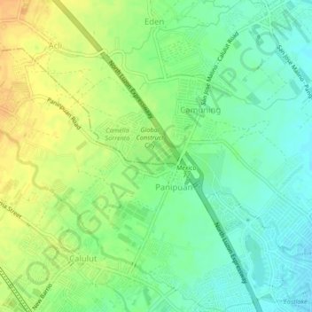
Name: Panipuan topographic map, elevation, terrain.
Location: Panipuan, Mexico, Pampanga, Central Luzon, 2021, Philippines (15.08500 120.64062 15.12500 120.68062)
Average elevation: 36 m
Minimum elevation: 20 m
Maximum elevation: 51 m
Thank you for supporting this site ❤️
Make a donation
Make a donation
Gear up for your next adventure:
As an Amazon Associate, this site earns from qualifying purchases at no extra cost to you.