Geolocate

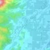
Māpua topographic map

Click on the map to display elevation.

About this map

Name: Māpua topographic map, elevation, terrain.

Location: Māpua, Tasman District, Tasman, 7005, New Zealand (-41.29321 173.05622 -41.21321 173.13622)

Average elevation: 23 m

Minimum elevation: -1 m

Maximum elevation: 136 m

Other topographic maps

Click on a map to view its topography, its elevation and its terrain.

Maruia River

New Zealand > Tasman > Tasman District

Average elevation: 761 m

Tākaka River

New Zealand > Tasman > Tasman District

Average elevation: 611 m

Motueka River

New Zealand > Tasman > Tasman District

Average elevation: 538 m

Brown River

New Zealand > Tasman > Tasman District

The source of the Brown River is near Brown Hill (elevation 1,104 metres or 3,622 feet) and the river flows north from the ridgeline adjacent to this hill. The Heaphy Track is on the south side of that ridgeline, with the river's source roughly halfway between Aorere Shelter and Flanagans Corner (the track's…

Average elevation: 625 m
Saddle Creek

New Zealand > Tasman > Tasman District

Average elevation: 853 m

Motueka River

New Zealand > Tasman > Tasman District > Motueka

Average elevation: 66 m

Gear up for your next adventure:

🎒40L Day Hiking Backpacks - Comfortable packs with hydration support for long days exploring topographic peaks
🌿Flora and Fauna Field Guides - Identify the plants and animals you encounter on your route
🔋Solar Power Banks - Solar chargers for outdoors
🐍Australian Snake Bite Kits - Specific pressure immobilization bandages for Australian venomous snakes
🥾Hiking Boots - Durable hiking boots for trails and rough terrain

As an Amazon Associate, this site earns from qualifying purchases at no extra cost to you.