Aachen topographic map
Click on the map to display elevation.
Aachen
The maximum dimensions of the city's territory are 21.6 km (13+3⁄8 mi) from north to south, and 17.2 km (10+3⁄4 mi) from east to west. The city limits are 87.7 km (54+1⁄2 mi) long, of which 23.8 km (14+3⁄4 mi) border Belgium and 21.8 km (13+1⁄2 mi) the Netherlands. The highest point in Aachen, located in the far southeast of the city, lies at an elevation of 410 m (1,350 ft) above sea level. The lowest point, in the north, and on the border with the Netherlands, is at 125 m (410 ft).
About this map
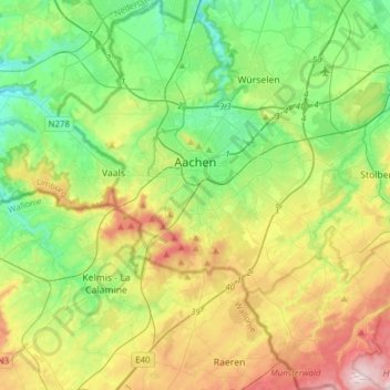
Name: Aachen topographic map, elevation, terrain.
Location: Aachen, Städteregion Aachen, North Rhine-Westphalia, Germany (50.66214 5.97486 50.85724 6.21811)
Average elevation: 225 m
Minimum elevation: 103 m
Maximum elevation: 456 m
Other topographic maps
Click on a map to view its topography, its elevation and its terrain.