Geolocate

Visby topographic map

Click on the map to display elevation.

About this map
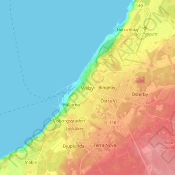
Name: Visby topographic map, elevation, terrain.

Location: Visby, Gotland Municipality, Gotland County, 621 45, Sweden (57.59794 18.25798 57.67794 18.33798)

Average elevation: 30 m

Minimum elevation: -1 m

Maximum elevation: 78 m

Gear up for your next adventure:

🎒40L Day Hiking Backpacks - Comfortable packs with hydration support for long days exploring topographic peaks
🚴Bike GPS - GPS devices for cycling
🏃Compression Recovery Socks - Reduce leg fatigue after heavy days of elevation gain
📡Portable Emergency Radios - Stay informed about weather warnings and bushfire alerts
📚Map Reading & Navigation Guides - Master the art of interpreting topographic contours and symbols

As an Amazon Associate, this site earns from qualifying purchases at no extra cost to you.