
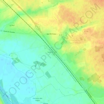
Saint-Imbert topographic map
Interactive map
Click on the map to display elevation.
About this map
Name: Saint-Imbert topographic map, elevation, terrain.
Average elevation: 206 m
Minimum elevation: 189 m
Maximum elevation: 227 m
Other topographic maps
Click on a map to view its topography, its elevation and its terrain.
Saint-Imbert
France > Bourgogne-Franche-Comté > Nièvre > Chantenay-Saint-Imbert
Saint-Imbert, Chantenay-Saint-Imbert, Nevers, Nièvre, Bourgogne-Franche-Comté, France métropolitaine, 58240, France
Average elevation: 206 m