
Česká Kubice topographic map
Interactive map
Click on the map to display elevation.
About this map
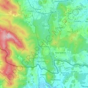
Name: Česká Kubice topographic map, elevation, terrain.
Average elevation: 570 m
Minimum elevation: 397 m
Maximum elevation: 1,036 m
Other topographic maps
Click on a map to view its topography, its elevation and its terrain.
Mýto
Czechia > Southwest > Plzeňský kraj
Mýto, okres Rokycany, Plzeňský kraj, Southwest, 338 05, Czechia
Average elevation: 507 m