Geolocate

Viella topographic map

Interactive map

Click on the map to display elevation.

About this map

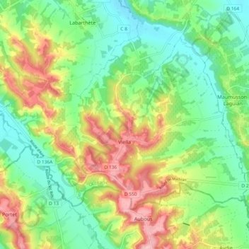
Name: Viella topographic map, elevation, terrain.

Location: Viella, Mirande, Gers, Occitania, Metropolitan France, 32400, France (43.57966 -0.18853 43.62534 -0.09651)

Average elevation: 164 m

Minimum elevation: 104 m

Maximum elevation: 260 m

Other topographic maps

Click on a map to view its topography, its elevation and its terrain.

Villecomtal-sur-Arros

France > Occitania > Gers

Villecomtal-sur-Arros, Mirande, Gers, Occitania, Metropolitan France, 32730, France

Average elevation: 206 m

Mirepoix

France > Occitania > Gers

Mirepoix, Auch, Gers, Occitania, Metropolitan France, 32390, France

Average elevation: 159 m

Lussan

France > Occitania > Gers

Lussan, Auch, Gers, Occitania, Metropolitan France, 32270, France

Average elevation: 205 m

Lectoure

France > Occitania > Gers

Lectoure, Condom, Gers, Occitania, Metropolitan France, 32700, France

Average elevation: 138 m