
Thank you for supporting this site ❤️
Make a donation
Make a donation
Gear up for your next adventure:
As an Amazon Associate, this site earns from qualifying purchases at no extra cost to you.
Fontezuelas topographic map
Click on the map to display elevation.
Thank you for supporting this site ❤️
Make a donation
Make a donation
Gear up for your next adventure:
As an Amazon Associate, this site earns from qualifying purchases at no extra cost to you.
About this map
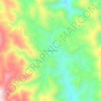
Name: Fontezuelas topographic map, elevation, terrain.
Location: Fontezuelas, Metztitlán, Hidalgo, Mexico (20.46795 -98.89459 20.50795 -98.85459)
Average elevation: 2,182 m
Minimum elevation: 1,919 m
Maximum elevation: 2,543 m
Thank you for supporting this site ❤️
Make a donation
Make a donation
Gear up for your next adventure:
As an Amazon Associate, this site earns from qualifying purchases at no extra cost to you.