
San Pedro de Pilpa topographic map
Interactive map
Click on the map to display elevation.
About this map
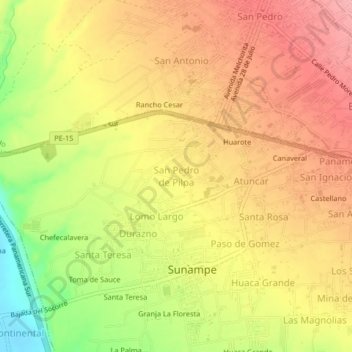
Name: San Pedro de Pilpa topographic map, elevation, terrain.
Location: San Pedro de Pilpa, Sunampe, Chincha, Ica, Perú (-13.43666 -76.18612 -13.39666 -76.14612)
Average elevation: 70 m
Minimum elevation: 4 m
Maximum elevation: 111 m
Other topographic maps
Click on a map to view its topography, its elevation and its terrain.
Granja La Floresta
Perú > Ica > Sunampe > Santa Catalina
Granja La Floresta, Santa Catalina, Sunampe, Chincha, Ica, Perú
Average elevation: 50 m