
La Magdalena topographic map
Interactive map
Click on the map to display elevation.
About this map
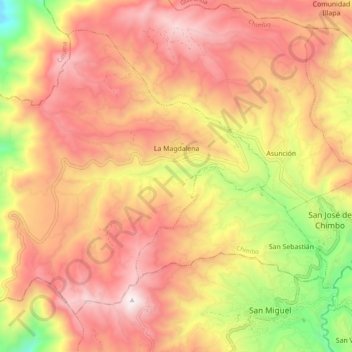
Name: La Magdalena topographic map, elevation, terrain.
Location: La Magdalena, Chimbo, Bolívar, Ecuador (-1.71156 -79.13895 -1.63139 -79.04237)
Average elevation: 2,748 m
Minimum elevation: 2,004 m
Maximum elevation: 3,261 m
Other topographic maps
Click on a map to view its topography, its elevation and its terrain.