
Ein Bokek topographic map
Interactive map
Click on the map to display elevation.
About this map
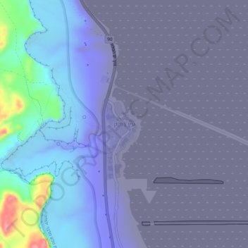
Name: Ein Bokek topographic map, elevation, terrain.
Average elevation: -278 m
Minimum elevation: -394 m
Maximum elevation: 95 m
Other topographic maps
Click on a map to view its topography, its elevation and its terrain.
Masada
Israel > South District > Tamar Regional Council
Masada, Ramp path, Tamar Regional Council, South District, no, Israel
Average elevation: -133 m