
Tiburon Island topographic map
Interactive map
Click on the map to display elevation.
About this map
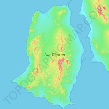
Name: Tiburon Island topographic map, elevation, terrain.
Location: Tiburon Island, Sonora, Mexico (28.74683 -112.58435 29.24624 -112.18887)
Average elevation: 87 m
Minimum elevation: -1 m
Maximum elevation: 1,012 m
Other topographic maps
Click on a map to view its topography, its elevation and its terrain.