Geolocate

Bonnie Brook topographic map

Click on the map to display elevation.

About this map

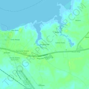
Name: Bonnie Brook topographic map, elevation, terrain.

Location: Bonnie Brook, Dorchester County, Maryland, United States (38.53567 -76.04105 38.57567 -76.00105)

Average elevation: 5 m

Minimum elevation: -4 m

Maximum elevation: 12 m

Gear up for your next adventure:

👕UPF 50+ Sun Shirts - Essential protection against the harsh Australian sun during field work
🧤Hiking Gloves - Protective gloves for outdoor use
🔪Outdoor Multi-tools - Versatile tools for gear repair and survival tasks in the wilderness
🔋Solar Power Banks - Charge your phone and GPS using the sun while deep in the bush
🔪Camping Knives - Multi-purpose outdoor knives

As an Amazon Associate, this site earns from qualifying purchases at no extra cost to you.