
Make a donation
Gear up for your next adventure:
As an Amazon Associate, this site earns from qualifying purchases at no extra cost to you.
Aichach topographic map
Click on the map to display elevation.
Make a donation
Gear up for your next adventure:
As an Amazon Associate, this site earns from qualifying purchases at no extra cost to you.
About this map
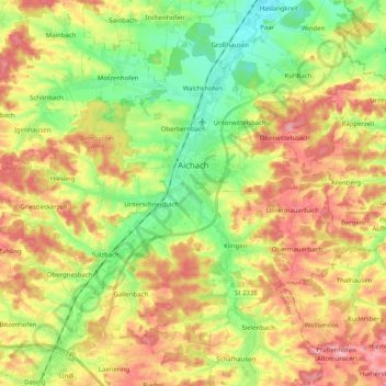
Name: Aichach topographic map, elevation, terrain.
Location: Aichach, Landkreis Aichach-Friedberg, Bavaria, 86551, Germany (48.39636 11.01204 48.50236 11.21434)
Average elevation: 482 m
Minimum elevation: 426 m
Maximum elevation: 543 m
Make a donation
Gear up for your next adventure:
As an Amazon Associate, this site earns from qualifying purchases at no extra cost to you.
Other topographic maps
Click on a map to view its topography, its elevation and its terrain.
Sankt Stephan
Germany > Bavaria > Landkreis Aichach-Friedberg > Sankt Stephan
Average elevation: 444 m
Make a donation
Gear up for your next adventure:
As an Amazon Associate, this site earns from qualifying purchases at no extra cost to you.