
Thank you for supporting this site ❤️
Make a donation
Make a donation
Gear up for your next adventure:
As an Amazon Associate, this site earns from qualifying purchases at no extra cost to you.
Webling topographic map
Click on the map to display elevation.
Thank you for supporting this site ❤️
Make a donation
Make a donation
Gear up for your next adventure:
As an Amazon Associate, this site earns from qualifying purchases at no extra cost to you.
About this map
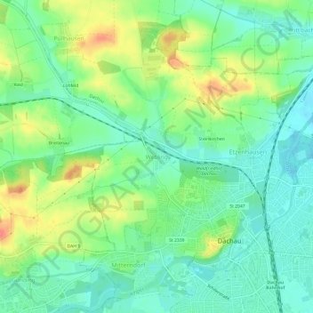
Name: Webling topographic map, elevation, terrain.
Location: Webling, Dachau, Landkreis Dachau, Bavaria, 85221, Germany (48.25001 11.40145 48.29001 11.44145)
Average elevation: 495 m
Minimum elevation: 472 m
Maximum elevation: 536 m
Thank you for supporting this site ❤️
Make a donation
Make a donation
Gear up for your next adventure:
As an Amazon Associate, this site earns from qualifying purchases at no extra cost to you.