
Thank you for supporting this site ❤️
Make a donation
Make a donation
Gear up for your next adventure:
As an Amazon Associate, this site earns from qualifying purchases at no extra cost to you.
Auric topographic map
Click on the map to display elevation.
Thank you for supporting this site ❤️
Make a donation
Make a donation
Gear up for your next adventure:
As an Amazon Associate, this site earns from qualifying purchases at no extra cost to you.
About this map
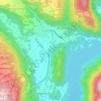
Name: Auric topographic map, elevation, terrain.
Location: Auric, Sassei, Mellame, Arsiè, Belluno, Veneto, Italy (45.97784 11.75878 45.97848 11.75980)
Average elevation: 403 m
Minimum elevation: 249 m
Maximum elevation: 734 m
Thank you for supporting this site ❤️
Make a donation
Make a donation
Gear up for your next adventure:
As an Amazon Associate, this site earns from qualifying purchases at no extra cost to you.