
Battaramulla topographic map
Interactive map
Click on the map to display elevation.
About this map
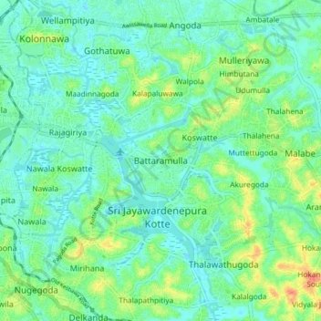
Name: Battaramulla topographic map, elevation, terrain.
Average elevation: 12 m
Minimum elevation: -2 m
Maximum elevation: 42 m
Other topographic maps
Click on a map to view its topography, its elevation and its terrain.
Ganehena
Sri Lanka > Western Province > Battaramulla > Ganehena
Ganehena, Battaramulla, Colombo District, Western Province, 10120, Sri Lanka
Average elevation: 13 m