Geolocate

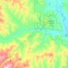
Conconully topographic map

Click on the map to display elevation.

About this map

Name: Conconully topographic map, elevation, terrain.

Location: Conconully, Okanogan County, Washington, 98819, United States (48.55316 -119.75847 48.56591 -119.74576)

Average elevation: 832 m

Minimum elevation: 691 m

Maximum elevation: 1,161 m

Other topographic maps

Click on a map to view its topography, its elevation and its terrain.

Chesaw

United States > Washington > Okanogan County

Average elevation: 1,046 m

Raven Ridge

United States > Washington > Okanogan County

Average elevation: 1,644 m

Aeneas

United States > Washington > Okanogan County

Average elevation: 897 m

Bonaparte Lake

United States > Washington > Okanogan County

Average elevation: 1,254 m

Methow

United States > Washington > Okanogan County

Average elevation: 487 m

Point Defiance

United States > Washington > Okanogan County

Average elevation: 1,839 m

Mazama

United States > Washington > Okanogan County

Average elevation: 827 m

Molson

United States > Washington > Okanogan County

Average elevation: 1,206 m

Goat Peak

United States > Washington > Okanogan County

Goat Peak is a 7,001-foot (2,134 m) peak in the North Cascades of Washington, United States. The summit offers broad views of the Methow River valley, as well as many of the other prominent cascade peaks including glaciated Silver Star Mountain. A working US Forest Service fire lookout is located on the…

Average elevation: 1,658 m

Carlton

United States > Washington > Okanogan County

Average elevation: 591 m

Wauconda

United States > Washington > Okanogan County

Average elevation: 1,183 m

Mazama

United States > Washington > Okanogan County

Average elevation: 827 m

Aeneas

United States > Washington > Okanogan County

Average elevation: 897 m

Twisp River

United States > Washington > Okanogan County > Twisp

Average elevation: 1,021 m

Mazama

United States > Washington > Okanogan County

Average elevation: 827 m

Dutton Lakes

United States > Washington > Okanogan County

Average elevation: 2,093 m

Gear up for your next adventure:

🧴SPF 50+ Bulk Sunscreen - Maximum protection for long-term outdoor exposure
🪢550 Survival Paracord - Versatile cordage for gear repair and emergency lashing
🦯Adjustable Trekking Poles - Reduce impact on knees when descending steep topographic ridges
🦟Heavy Duty Insect Repellent - Essential protection against flies, mozzies, and march flies
🧊Insulated Cooler Bags - Keep food fresh for day trips to remote geographic sites

As an Amazon Associate, this site earns from qualifying purchases at no extra cost to you.