
Thank you for supporting this site ❤️
Make a donation
Make a donation
Gear up for your next adventure:
As an Amazon Associate, this site earns from qualifying purchases at no extra cost to you.
Bronschhofen topographic map
Click on the map to display elevation.
Thank you for supporting this site ❤️
Make a donation
Make a donation
Gear up for your next adventure:
As an Amazon Associate, this site earns from qualifying purchases at no extra cost to you.
About this map
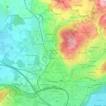
Name: Bronschhofen topographic map, elevation, terrain.
Location: Bronschhofen, Wil (SG), Wahlkreis Wil, Saint-Gall, 9551, Suisse (47.45566 9.01697 47.49566 9.05697)
Average elevation: 587 m
Minimum elevation: 508 m
Maximum elevation: 733 m
Thank you for supporting this site ❤️
Make a donation
Make a donation
Gear up for your next adventure:
As an Amazon Associate, this site earns from qualifying purchases at no extra cost to you.