Geolocate

Findon topographic map

Click on the map to display elevation.

About this map

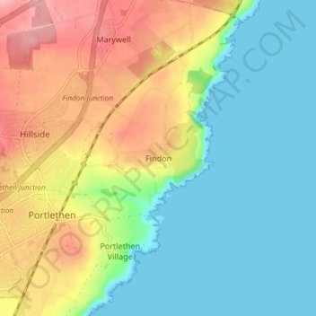
Name: Findon topographic map, elevation, terrain.

Location: Findon, Aberdeenshire, Scotland, AB12 3RP, United Kingdom (57.04867 -2.12489 57.08867 -2.08489)

Average elevation: 45 m

Minimum elevation: 0 m

Maximum elevation: 120 m

Gear up for your next adventure:

🧼Clip-on Hand Sanitizer - Maintain hygiene when water for washing is scarce
🎒Ultralight Backpacks - Lightweight packs for long hikes
🧦Merino Wool Hiking Socks - Moisture-wicking socks to prevent blisters during long topographic surveys
🧢Outdoor Sun Hats - Sun protection hats for hiking
🔪Multitools - Compact tools for outdoor use

As an Amazon Associate, this site earns from qualifying purchases at no extra cost to you.