Geolocate

Stokmarknes topographic map

Click on the map to display elevation.

About this map

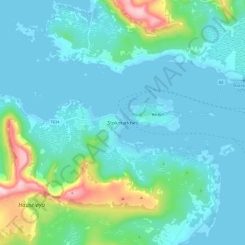
Name: Stokmarknes topographic map, elevation, terrain.

Location: Stokmarknes, Hadsel, Nordland, 8450, Norway (68.52700 14.87335 68.60700 14.95335)

Average elevation: 85 m

Minimum elevation: -3 m

Maximum elevation: 560 m

Gear up for your next adventure:

🛌Compact Down Sleeping Bags - Warmth without the bulk, ideal for backcountry camping
🪢550 Survival Paracord - Versatile cordage for gear repair and emergency lashing
👟Lightweight Trail Runners - Agile footwear for fast movement over rugged Australian terrain
🎒Tactical Waist Packs - Quick access to your compass, phone, and snacks while walking
🩹First Aid Kits - Emergency kits for hiking

As an Amazon Associate, this site earns from qualifying purchases at no extra cost to you.