
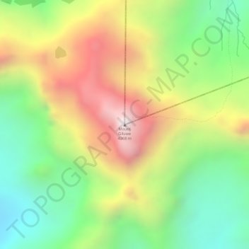
Mount Giluwe topographic map
Interactive map
Click on the map to display elevation.
About this map
Name: Mount Giluwe topographic map, elevation, terrain.
Average elevation: 3,864 m
Minimum elevation: 3,460 m
Maximum elevation: 4,327 m
Other topographic maps
Click on a map to view its topography, its elevation and its terrain.
Mendi
Papua New Guinea > Southern Highlands > Mendi District
Mendi, Mendi District, Southern Highlands, Highlands Region, Papua New Guinea
Average elevation: 1,972 m
Nipa District
Papua New Guinea > Southern Highlands
Nipa District, Southern Highlands, Highlands Region, Papua New Guinea
Average elevation: 1,418 m