Geolocate

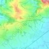
Ansfelden topographic map

Click on the map to display elevation.

About this map

Name: Ansfelden topographic map, elevation, terrain.

Location: Ansfelden, Bezirk Linz-Land, Upper Austria, 4053, Austria (48.16749 14.22807 48.23508 14.32928)

Average elevation: 302 m

Minimum elevation: 255 m

Maximum elevation: 383 m

Other topographic maps

Click on a map to view its topography, its elevation and its terrain.
Thurnharting

Austria > Upper Austria > Bezirk Linz-Land

Average elevation: 324 m

Gear up for your next adventure:

🔦LED Torches - LED torches for outdoor use
🪑Portable Backpacking Chairs - A comfortable seat for studying maps at the end of the day
📡Weather Radios - Emergency weather radios
🩹Wilderness First Aid Kits - Comprehensive medical kits tailored for hiking and remote exploration
🔥Camping Stoves - Portable stoves for outdoor cooking

As an Amazon Associate, this site earns from qualifying purchases at no extra cost to you.