
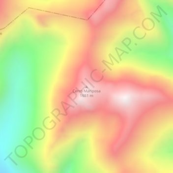
Cerro Mariposa topographic map
Interactive map
Click on the map to display elevation.
About this map
Name: Cerro Mariposa topographic map, elevation, terrain.
Average elevation: 1,258 m
Minimum elevation: 711 m
Maximum elevation: 1,702 m
Other topographic maps
Click on a map to view its topography, its elevation and its terrain.
Lago Largo
Chile > Región Aysén del General Carlos Ibáñez del Campo > Coyhaique > Lago Largo
Lago Largo, Coyhaique, Provincia de Coyhaique, Región Aysén del General Carlos Ibáñez del Campo, Chile
Average elevation: 780 m
Volcán Hudson
Chile > Región Aysén del General Carlos Ibáñez del Campo > Coyhaique
Volcán Hudson, Coyhaique, Provincia de Coyhaique, Región Aysén del General Carlos Ibáñez del Campo, Chile
Average elevation: 1,431 m
Reserva Nacional Trapananda
Chile > Región Aysén del General Carlos Ibáñez del Campo > Coyhaique
Reserva Nacional Trapananda, Cruce Ruta 7 (Villa Ortega) - Ñirehuao - Paso Pampa Alta, Mano Negra, Coyhaique, Provincia de Coyhaique, Región Aysén del General Carlos Ibáñez del Campo, Chile
Average elevation: 1,034 m