
Nöham topographic map
Interactive map
Click on the map to display elevation.
About this map
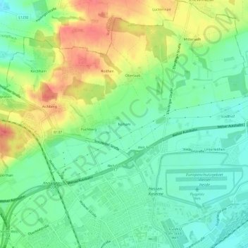
Name: Nöham topographic map, elevation, terrain.
Location: Nöham, Wels, Oberösterreich, 4600, Österreich (48.17142 14.00074 48.21142 14.04074)
Average elevation: 332 m
Minimum elevation: 307 m
Maximum elevation: 372 m
Other topographic maps
Click on a map to view its topography, its elevation and its terrain.
Wels
Österreich > Oberösterreich > Wels
Wels, Oberösterreich, 4600, Österreich
Average elevation: 343 m