Geolocate

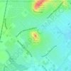
Joshua topographic map

Click on the map to display elevation.

About this map

Name: Joshua topographic map, elevation, terrain.

Location: Joshua, Johnson County, Texas, 76058, United States (32.43271 -97.46380 32.49180 -97.36012)

Average elevation: 269 m

Minimum elevation: 225 m

Maximum elevation: 315 m

Other topographic maps

Click on a map to view its topography, its elevation and its terrain.

Highland

United States > Texas > Johnson County

Average elevation: 198 m

Turkey Peak

United States > Texas > Johnson County > Burleson

Average elevation: 237 m

Oak Hill

United States > Texas > Johnson County > Cleburne

Average elevation: 240 m

Gear up for your next adventure:

🧢Wide Brim Sun Hats - Maximum coverage for the face and neck while out in the open
🧭Compass - Navigation compasses for outdoor exploration
🧺Fast-Dry Microfiber Towels - Large towels that pack down to the size of an orange
🕶️Polarized Outdoor Sunglasses - Reduce glare from rocks and water for better visual navigation
🧰Survival Kits - Essential survival gear

As an Amazon Associate, this site earns from qualifying purchases at no extra cost to you.