
Aberteifi / Cardigan topographic map
Interactive map
Click on the map to display elevation.
About this map
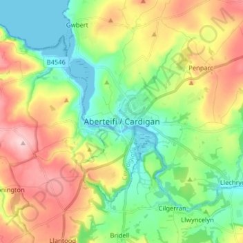
Name: Aberteifi / Cardigan topographic map, elevation, terrain.
Location: Aberteifi / Cardigan, Ceredigion, Gales, SA43 1JR, Reino Unido (52.04400 -4.70042 52.12400 -4.62042)
Average elevation: 81 m
Minimum elevation: -1 m
Maximum elevation: 207 m